
A 90 mile walk across Wirral and Cheshire with a focus on wildlife
Introduction
In the early 1960s the world woke up to the fact that modern living practices were seriously damaging wildlife, not only in exotic places like Africa, but also at home in the UK. Until that time the state of the ecosystem was just not on people’s minds. The response to this across the country was to create Wildlife Trusts. Sixty years on, there has been a sea-change in awareness. Global warming, the climate emergency and the regular reduction of wild animal numbers are constantly in the news – so it seems a good time to explore what is actually happening ‘on the ground’.
The area I have chosen to explore is the historic county of Cheshire. I spent my formative years here so I remember it from those early days and my father, after whom the walk is named, was chair of the Mid Cheshire branch of the Cheshire Wildlife Trust from its creation for over 35 years so I am familiar with some of the Trust’s early work. The Trust covered the whole of what was then Cheshire and although local government has since undergone several reorganisations, the Trust’s brief is unchanged so it now spans Wirral, Cheshire West and Chester, Cheshire East, and some unitary authorities.
Our 90-mile walk spans historic Cheshire starting in the coastal town of Hoylake in Wirral, and ending at Shining Tor, which is Cheshire’s highest point at the eastern boundary of Cheshire East. It explores as many Trust reserves as possible en route, as well as wildlife areas managed by local authorities, the RSPB, the National Trust, and Canal and River Trust.
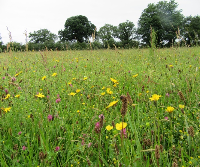
But Cheshire has much more to offer than just wildlife, so the route explores the sandstone outcrops of Wirral and Delamere; celebrates the beautiful farm buildings and hedges of the Cheshire Plain; follows estuaries, rivers and canals; visits Chester, and several smaller towns; passes areas of natural beauty and enjoys several superb viewpoints. The gradients may be easier than some Long-Distance Paths, but the route is no less varied or impressive.
My objectives in developing this route were:
- To highlight the wildlife of the area.
- To celebrate some of the best scenery and historic sites across Cheshire.
- To raise funds for Wildlife. Our wildlife is threatened as never before and will only survive with our active support.
The Cheshire Wildlife Trust
The Cheshire Wildlife Trust does amazing work in helping to both conserve existing wildlife and reintroduce new wildlife habitats – details can be found on their website at https://www.cheshirewildlifetrust.org.uk/. Unsurprisingly this guide makes numerous references to the Trust so I have abbreviated their name to CWT from here on.
The CWT has given me significant help in developing this walk, but it is important to state that this walk guide is a personal project by the author. THE CHESHIRE WILDLIFE TRUST HAS NOT DEVISED IT AND HAS NO RESPONSIBILITY FOR ANY ASPECT OF IT. If you have any concerns or comments about the walk, please DO NOT contact the Trust but use the links provided to contact me.
The CWT was a major part of Eric Thurston’s life and so, in keeping with his commitment to them, I have made supporting the Trust a key objective of this walk. All profit from the sale of the book go to the Cheshire Wildlife Trust. In addition, we encourage you to consider making a donation or getting sponsorship while walking the route – whether doing the whole route or just part of it. Payment of the sponsorship money can be made to the CWT at Bickley Hall Farm, Malpas, Cheshire, SY14 8EF, or through their website at https://www.cheshirewildlifetrust.org.uk/support-us/donate . If you enjoy the walk why not become a member?
Your donations, whether large or small, will make a difference, so Thank You.
About Eric Thurston

Eric was born in Kings Lynn, Norfolk in 1917, but for health reasons spent long periods of his childhood living with his grandparents in the countryside, where he learned much about the countryside from his grandfather – an agricultural labourer. It is from these early experiences that he developed his lifelong passion for wildlife.
He spent all his career at ICI, Northwich, initially as a research chemist, but was appointed as their first Environmental Officer because of his knowledge of nature, a pioneer in this role, helping to create the profession it has become today.
As a keen naturalist he was a founder member of the Cheshire Wildlife Trust, and he chaired the Mid-Cheshire Group of the Trust from its formation in 1963 to the late 1990s, coordinating activities, recruiting members, and assisting in the acquisition of several reserves. He was an early advocate of the concept of ‘wildlife corridors’ to provide a route for wildlife to migrate between reserves, recognising the value of railway embankments, canals, and (the then-new) motorway embankments.
He was a keen amateur photographer, and used his pictures to give slide shows to local groups – Women’s Institutes, church groups, Probus clubs, youth groups and others – to raise funds for the Cheshire Wildlife Trust. After his passing in 1999 the Trust set up the Eric Thurston Award, which it continues to present annually.
This Guide
This guide describes the route from west to east (Hoylake to Shining Tor). The one exception is the that the section from Langley to Shining Tor is also described in reverse to make the most of walking this downhill. The walk is designed for people with an interest either in Long Distance Footpaths or observing wildlife (or both!). Watching wildlife takes time – so the walk is intended to be taken at a gentle pace, particularly on Reserves – and you are encouraged to plan a schedule which allows for this.
This guide is designed to minimise the carbon footprint of walkers by including links to public transport information on buses & trains to get to and from each day’s walk. Services do change without notice, so please check before relying on them.

The route is shown on the 1:50000 O/S maps with a blue line. Alternative routes may be shown as a row of blue dots. All 1:50000 maps are reproduced by permission of Ordnance Survey © Crown copyright 2019 reproduced under license CS-110739-J1J6D8.
I have added references to What3Words coordinates in key places – shown thus ///first.second.third.
The route mostly follows footpaths, bridleways, and byways. I hope to waymark the route on these at some time, but this has yet to be agreed with Local Authority Rights of Way teams.
Road walking is mainly along quite lanes to minimise interaction with traffic, but inevitably there are some busier road sections. Either way, some level of risk is unavoidable, so you are reminded that at all times your safety is your own responsibility.
Where the route crosses nature reserves, woods, heaths, and suburban areas, there can be many more paths than those shown on O/S maps. To help here, the narrative is more detailed, and is sometimes supplemented by a sketch map (probably still not showing all paths!). If you wander off-route in these areas, always follow official paths and do not go ‘across country’ as some habitats are delicate and this could cause damage.
Inevitably in developing this route many other wonderful reserves had to be omitted as they are just too far off the route to be included. If you enjoy this walk, why not find some of these for yourself – a good starting point is the Reserves map on the Cheshire Wildlife Trust website.
A Walkers code for the Wildlife Way
Traffic safety. Be mindful of traffic, not only on busy roads, but also on byways where vehicles may not be expecting walkers round bends. Walk where you can see and be seen. Ultimately your safety is your own responsibility – so take great care.
Navigation. Consider taking a GPS system with you in case you get lost, or if you are planning to explore a reserve more widely and need to reach the correct leaving point!
Transport: If, like me, you walk an LDP in sections, one issue is getting from the end of a day’s walk back to the start. Some people take 2 cars and drop one at each end of the walk, but a far more environmentally-friendly way is to use public transport. I have therefore identified public transport links along the route.
Respect the needs of rural workers. This may be fun for you but is their workplace.
Respect the needs of wildlife. Many habitats are finely balanced so dropping rubbish, causing disturbance, or even just compacting the ground or making it too muddy by overuse can all have a negative impact. Always stay on recognised paths in nature reserves, and do not go ‘cross-country’
Footpath issues: If you come across an issue with a footpath, please contact the Public Rights of Way Officer at the relevant council (Wirral, Cheshire West, or Cheshire East). Do not contact the CWT as they have no responsibility for it.
For the inexperienced Naturalist: Finally – Please don’t expect to see wildlife on this walk like a David Attenborough wildlife documentary! Instead, think of them more like visiting a huge enclosure at a zoo where you look around and often see nothing, or maybe just a greyish lump in the distance which you guess is the animal asleep! Wildlife can often be very elusive. Sometimes they are simply absent (particularly if they are seasonal visitors); in some reserves they may just be very small (e.g. insects) or under water or down burrows. Don’t let that put you off – but rejoice in the fact that these habitats are protected primarily to ensure the species have a place to survive rather than for our entertainment, and if you glimpse one, be grateful! Giving it time (and space) helps!
Walking in Cheshire
Cheshire may not be the most obvious place for a long-distance walk, sandwiched between its more rugged neighbours of the Welsh Hills to its west and the Peak District to its east. However, to my mind, the Cheshire countryside has two crowning glories:
One is the wonderful hedgerows, lined at intervals with ancient trees – mainly oaks. As Cheshire is predominantly a dairy-farming county, these have survived better than in many other parts of the county, adding beauty to the landscape.
The other jewel in the crown is the vast number of small pools, hollows, meres and mosses – more than any other county in England. Most of these were created by one of two agents. Many are a left-over feature of the last ice age, when the ice was receding and large lumps of ice would break off the retreating ice-sheet and sink into the soft mud beneath. Then, as they melted a hollow would be left in the ground. Others are the remains of old marl pits – as marl was extracted from the ground and used to improve the soil for agriculture. I am told that a marl pit can be recognised as it has a steep bank on one side where the marl was being dug and a much gentler slope on the other side where carts would have been brought in to take the marl out. As time goes by both types of hole gradually fill in, changing from pool to moss, to marshy hollows, to damp depression. Each stage has its own wildlife characteristics. I encourage all walkers to look out for these on the route.
Together these create a rich variety of wildlife habitats, and are best explored on foot.
Inevitably in developing this route many other wonderful reserves had to be omitted as they are just too far off the route to be included. If you enjoy this walk, why not find some of these for yourself – a good starting point is the Reserves map on the Cheshire Wildlife Trust website.
Acknowledgements
I would like to express thanks to the Cheshire Wildlife Trust for the continuing support and encouragement they have given me as well as for providing and checking wildlife descriptions. Thanks also to Tim Brunton – the founder of the Cross Britain Macmillan Way – for support and advice on how to turn the concept of an LDP into reality. Thanks to the Public Rights of Way officers from the local authorities for their support. And finally thanks to my family for tolerating the many hours while in Indulged in developing this, for support, planning, proofreading and particularly my wife Margaret for supporting my walking and my son Tom for technical help to develop the website and book.
